 |
| Atop the pass with Adishi Glacier behind |
Note: A couple of weeks have passed since I finished writing this, but the terrible internet connection we had in Biscione prevented me from uploading then. We have now made it to Bali, and now have a dependable lifeline into cyberspace, so I can now post.
November 14, 2020
Terri and I are nearing
the end of our month of enforced leisure here on the western end of
Sicily. Biscione has been a wonderful
place to hide out from covid-19 while waiting for visas and developments in the
world of travel. When we got together in
Switzerland in the middle of August, Europe had very low covid case numbers and
life was deceptively normal. Now, three
months later, Europe is inundated by covid again, with more cases and
hospitalizations than during the terrible days of March and April. With hospitals filling up, deaths are
increasing steadily and a return to a full lockdown regime, as was the case in
March, April and May across much of Europe, seems inevitable. Italy, with case numbers skyrocketing, is
inching that way, so we are glad to be escaping just as the situation goes from
bad to critical. If all goes well, in 2
weeks we should be back in our beloved Bali, as the Indonesian government has
authorized the granting of (very expensive) “business” visas. It will be as enjoyable a place as anywhere
to wait out the next six months while we see what will happen in the world of
travel.
So while we wait, Terri
and I are enjoying being close to the Mediterranean shore. We try to swim every day (although the water
is a bracing 18-20 degrees, so it’s not exactly tropical), and we go out for
runs or bike rides. Occasionally we
venture out in search of ruins or new beaches, but for the most part we stay
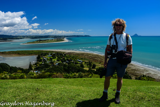
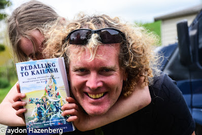
close to the little yellow beach house we have rented for a month. I have been working on the manuscript of my
book Pedalling to Kailash, which I hope to self-publish shortly on Kindle
Direct Publishing, but with that project nearing completion, I think it’s time
to bring my blog up to date by writing up a couple of trips that never made it
onto the blog thanks to a combination of laziness and being busy.
Extending an Epic Summer of Trekking
Last summer, in the
bygone days of 2019 when international travel was inexpensive and possible and fun,
Terri and I went off to Kyrgyzstan for half of June and all of July. It was a magical 7 weeks of hiking and horse
riding in the mountains of that amazing outdoor playground of a country, and I
wrote about our hiking around Karakol and along the mighty Inylchek glacier, as
well as our madcap horse trek to remote Kel Suu, a lake along the Chinese
border. We flew back to Tbilisi at the
beginning of July with two and a half weeks free before my school year started
up again, and feeling ready for some exploration in Georgia.
After a couple of lazy
days of laundry, food and recovery at home in Tbilisi, we hopped into Douglas, our
beloved Mitsubishi Delica van, early one morning and headed out of town on the
hideously unpleasant main east-west highway.
At that time of year, everyone in Tbilisi heads out of town, either to
visit relatives in ancestral villages, or to go to the Black Sea coast near
Batumi. Georgian driving is aggressive
and dangerous at the best of times, but particularly when there’s a lot of
traffic and drivers get impatient. The
highway has been upgraded to a European-quality motorway for much of its
length, but the section leading between Khashuri and Zestaponi, over the Likhi
mountains, the barrier separating the eastern and western halves of the
country, remains a narrow, winding road with one lane in each direction,
clogged with trucks driving slowly over the pass. The passing attempts we watched unfold in
front of us were horrifying kamikaze manoeuvres and we were glad to escape
unharmed from the traffic maelstrom and turn north towards the Racha region.
In my previous trips to
Georgia as a tourist, as well as during our first year in Tbilisi, Racha was
the one Caucasus region that I had never seen.
With the secession of South Ossetia, Racha is hard to get to, and
doesn’t connect well with other parts of the country. The most direct route from Tbilisi to Oni,
the regional capital, runs from Tbilisi to Gori and then on to Tskhinvali (the
capital of South Ossetia) and over a low pass into Oni. That route hasn’t been possible for a long
time (at least since 2008, and probably since 1994), and yet Google Maps, which
works very poorly in general in Georgia, insists on trying to send travellers along
this route. We followed the route
actually used today, away from the main highway along a newly paved road that
leads through the rather grim mining/logging town of Tkibuli, then up a
dramatic limestone mountain face (the Racha Range) along a series of dramatic
switchbacks before dropping onto a high plateau dominated by a hydroelectric
reservoir (Shaori Lake). It was
eye-catching scenery, and we vowed to come back sometime to explore further. From here the road led downhill, gently at
first, then quite precipitously, past the beautiful 11th-century
church of Nikortsminda where we stopped for a quick look.
 |
Mtsvadi skewers about to go on the grill
|
Eventually we emerged
into the Rioni river valley, the main axis of the Racha region, and turned
upstream. We passed through modern
Ambrolauri and stopped for fuel in Oni, the historic capital. We continued upstream, along an increasingly
dramatic river gorge, past a mineral spring in Utsera that disgorges almost
undrinkable water. When the road forked,
we turned right, towards Shovi and Glola.
These proved to be ramshackle villages with old abandoned Soviet resort
hotels. We cast around for a place to
camp, and ended up backtracking downstream to a pleasant meadow where we
grilled up a feast of mtsvadi skewers and slept peacefully, lulled by the roar
of the river and the drumming of rain on the roof of the van.
Our Udziro Odyssey
The plan was to hike up
to one of Racha’s best-known beauty spots, Udziro Lake. The lake lies high in the
range just south of the main range of the Caucasus. We had consulted maps and hiking guides, and
decided that the classic loop, starting at Shovi and returning to Glola, sounded
a bit dicey for our tastes. Instead we
opted to go up and down the same route from Glola, along a gentler path,
avoiding a very steep pass leading to the lake from the Shovi side. We woke up, packed our hiking backpacks for
our overnight hike, drove to Glola (elevation 1340 m) and parked in the shade
of a roadside tree. The weather looked a
bit dubious, with a light drizzle falling in Glola, but our forecast called for
it to stop, so we set off in high spirits, keen to continue our summer of
mountain exploration.
 |
Morning light on a peak in Racha
|
The path up was
relentlessly steep at first, through a dense, dripping spruce forest. The path was muddy and slippery in places,
and Terri was not looking forward to the descent the next day. It was oppressively humid and quite hot, and
sweat poured off our bodies. After a
couple of hours we emerged from the dense woods into patches of meadow that
were bursting with a profusion of wildflowers in full bloom. I took dozens of photos of new and unfamiliar
species, keen to identify them in my new wildflower guidebook. All the while, though, the weather looked
less and less promising. We spent a
while walking through mist, but then, as we rose higher above the treeline, the
drizzle restarted. It stopped long
enough for us to have a filling picnic of sardines, cheese and fresh bread in a
grassy open patch, but once we shouldered our packs again, the drizzle
returned, a bit more insistently this time.
 |
Distant peaks in Svaneti, seen from Udziro
|
The path gained ground
steadily through dense patches of rhododendron, crossed a small river and then
wound steeply uphill over a rocky ridge at 2660 metres’ elevation. At first we thought that this might be the
pass immediately before the lake, but this was overly optimistic. We dropped down the other side and then
continued to climb up a second valley.
The background scenery was dramatic, with jagged peaks made of crumpled
rock strata, although much of it kept teasing us through a veil of clouds. As we began the ascent of the steep final
pass, it began to rain a good deal harder.
The temperature, which had been so hot only a few hours before, began to
plummet, and soon we were shivering as cold winds blasted into our faces. By the time we reached Geske Pass, at an
altitude of 2880 metres (by my watch; the maps say more like 3070 metres) above sea level, the rain was starting to freeze and we
realized that we were in a tricky situation.
The clouds had completely enveloped us and we were unable to see more
than twenty metres ahead of us. We knew
that there was a campsite on some flat ground somewhere above the lake, but it
wasn’t clear exactly where it was. We
followed our GPS and eventually found what might have been the campsite. Terri was starting to shiver uncontrollably
by now, so rather than cast around further, we threw the tent up as quickly as
possible and she dived inside to huddle in her down sleeping bag.
 |
It was a distinctly chilly morning!
|
I wasn’t feeling the cold
as badly, so I put on all my warm layers and picked my way downhill in search
of the lake with our water bag. After a
while I found the path and made my circuitous way to the lake, a small glacial
tarn perhaps 100 vertical metres below our tent. As I wandered back uphill with 6 litres of
crystal clear water, I spotted another party of three trekkers making their way
down over the pass from the Shovi side.
It looked very steep and exposed, and I was glad that we weren’t trying
to make our way down it in freezing rain with full backpacks. The trekkers, three women from Slovakia, told
us the next morning that the descent had been faintly terrifying and much
harder than they had been led to believe.
I returned to the tent, fired up our stove and cooked up soup, tea,
sausages and mushrooms for dinner. Terri
was feeling a bit warmer, but still stayed swaddled in her sleeping bag while
eating. She has always suffered from
cold, and this was not a situation that her body relished. We turned in early and slept the sleep of the
tired, after almost 7 hours of hiking straight uphill.
 |
Udziro Lake in the morning
|
I awoke early the next
morning, almost with first light, and stuck my head out of the tent. The rain of the night before was over,
although our tent fly was rigid with ice.
The sky was perfectly clear, and for the first time I could see our
spectacular surroundings. I clambered
out of the tent with my camera and binoculars and went to explore, leaving
Terri fast asleep.
 |
At the Geske Pass
|
Our tent was on a small
plateau. Climbing up a few metres, I
looked down at Udziro Lake which gleamed an improbable shade of azure in the
early-morning light. Behind it a
sizeable peak, as jagged as a mouthful of shark’s teeth, striped with
alternating light and dark strata, loomed skyward. To its left was the pass I had seen the
Slovakian women descending, a smooth glacis of steeply inclined scree. I walked past their tents and uphill towards
our pass of the previous afternoon. A
few minutes later I was gazing out towards the west and a sea of distant
snow-capped peaks. A bit of thinking
about distances and directions convinced me that these must be the knot of high
peaks in the adjacent Svaneti region. I
peered through my binoculars at the mountains, just starting to light up orange
with the first rays of the sun, and recognized the unmistakeable twin summit of
Ushba, the iconic mountain of Svaneti, and, looming higher still, the steep summit ridge of Shkhara, the highest peak in Georgia. It was a breathtaking view, and
I sat there for a quarter of an hour drinking it in before returning to the
tent.
 |
Terri headed back towards Glola
|
Terri was just stirring
as I got back and fired up the stove.
I’ve relied on these MSR XGK stoves for the better part of two decades,
and while their performance is exemplary (as long as they have clean fuel),
they are really loud. Cooking beside
them is like being next to a jetliner taking off. I think that the noise probably woke up the
Slovaks, camped about fifty metres away, as I soon saw three sleepy, tousled
heads appear from their tents. Terri and
I cooked up a hearty breakfast of oatmeal, tea and coffee and lingered over it
until the sun appeared over the mountains to warm us and dry our soggy tent and
fly. We waved goodbye to the Slovaks
before finally packing up our camp and setting off again. We paused atop the pass so that Terri could
absorb the expansive views, then said farewell to Udziro and began the descent.
It was unsurprisingly
much easier to drop down again to Glola.
Along the path we met at least two dozen trekkers, some lugging full
packs like us, others carrying daypacks and planning to blitz up and down in
one long day. The day was gloriously
sunny, and the greens of the meadows contrasted with the deep blue of the sky,
the slate grey of the mountain peaks, the distant white of high glaciers and
the riotous purples, yellows and pinks of the wildflowers. It was a feast for the senses, and we walked
down happy with life. Our mood was
improved further by a session of foraging for raspberries in thickets beside
the trail. A relaxed picnic in a meadow
was followed by a prolonged muddy slither back through the forest; surprisingly
neither of us fell despite lots of slipping.
By 2:30, only 4 hours after setting off, we were back in Glola, muddy
but exultant. We rinsed the dense clumps of clay from our boots, then drove
downstream to camp near the road junction in a beautiful forest clearing. We grilled up more mtsvadi, drank copious
amounts of tea to rehydrate, then settled into sipping Georgian red wine. It was a relaxed, leisurely end to our climb.
 |
| A spiky ridge on the way down from Udziro |
Over the Zagari Pass
 |
Oni Synagogue
|
It was now time to say nakhvamdis to Racha after too short a
visit. We wanted to spend a week hiking
in Svaneti, and we needed to start making tracks. We awoke to rain, so it was
a slow getaway, cooking pancakes and eggs under a jerry-rigged tarp. By noon we were rolling back down the Rioni
towards Oni. We found its famous synagogue tucked into a side street and paid our respects. Georgia has had a Jewish community for at
least 2000 years, with a Jewish cemetery that’s been unearthed in the ancient
capital of Mtskheta. It’s not clear to
me why Oni, a small, remote town tucked into the mountains, ended up becoming a
centre of Jewish life in Georgia, but it did.
This synagogue isn’t terribly old, dating from the late 19th
century, but there is historical evidence of Jewish life in Oni dating back
almost as long as in Mtskheta. Most of
Oni’s Jews emigrated during the wave of Jewish emigration from the USSR in the
1980s and in the early years of Georgian independence in the 1990s. Now only a handful remain, but apparently one
of my students in Tbilisi, an Israeli, is the grandson of emigres from Oni who
have returned to set up a business and connect with their ancestral roots.
 |
Proud driver atop the Zagari Pass
|
We continued downstream
along the Rioni, through picturesque villages and the famous vineyards of
Khvanchkara (where Stalin’s favourite wine was produced), through dramatic rock
pillars, downstream until a junction at the town of Achara. Here we turned away from the Rioni and
climbed upstream along a narrow, beautiful tributary valley, on a road blasted
through in Soviet times with great determination. It reminded me, on a much smaller scale, of
the Rondu gorges on the Indus valley in northern Pakistan. After a while the river pooled behind a small
hydroelectric dam and we circled the reservoir before climbing steeply over a
pass and dropping down a cliff into the town of Tsageri, with its medieval
fortress. As we drove downhill into
town, we passed a small group of young men drinking a toast beside a roadside
memorial, presumably to one of their friends killed in a road accident there,
probably after having a few toasts too many.
 |
In a thicket of wildflowers
|
At this point we were
concerned about fuel, with a long stretch coming up without any gas stations
and some steep 4x4 driving that was sure to consume a lot of gasoline. We found a gas station in Tsageri, then
continued up the valley to Lentekhi. We spent a fair bit of time trying to find a
gas station; I asked a number of people in town, but following directions, we
didn’t see anything that looked likely.
Finally, on the fourth trip down a small street, we spotted a pump
tucked away in a tiny alleyway. We found
the owner and got him to fill us up; since we’d filled up in Tsageri, we only
needed 5 litres or so, but we were worried that it might be the difference
between arriving in Mestia safely, and having to hitchhike to town to buy fuel.
From Lentekhi we followed
a ribbon of newly-laid asphalt upstream, through a string of tiny
villages. This is Kvemo (Lower) Svaneti,
very much the under-visited and poorer cousin of Zemo Svaneti; the two halves
of Svaneti are separated by the Zagari Pass, towards which we were making our
way. I remembered the jeep track over
the pass as being truly awful, even for a mountain bike, from my visit in 2011. We were ready for anything, so when we drove
off the last of the lovely asphalt, we put Terri at the wheel as our designated
off-road specialist driver, engaged 4x4 and set off uphill.
 |
Dato showing the way to Tsana
|
The track was a muddy
mess, made worse by road maintenance work that sent us down along a temporary
trail. We met a couple of motorcyclists,
a muddy cyclist and two or three vehicles coming downhill. We talked to one of the motorcyclists and he
looked shattered; he said it had taken him 6 hours to get to that point from
Ushguli over the pass. Clearly the road
had not improved since my last visit.
Luckily, while we were waiting for a truck to pass coming in the other
direction, we struck up a conversation with Dato, the driver of a vehicle in
front of us. He said that he was headed
to the village of Tsana, just before the pass, and that he had a guesthouse
there in which we were welcome to stay.
When the track was clear, he zoomed off, handling the road with aplomb
even though he was towing a trailer and had tires that were almost bald. Terri did well to keep up, and
said afterwards that having him show the way made driving much easier, as she
could just follow his path without having to pick her way through the mud,
potholes, rocks and washboarding. We
zipped along at a decent clip, and, in the early evening, pulled into Tsana, a
village of perhaps 20 houses, 3 of which looked as though they were still
occupied.
 |
Douglas and friend in Tsana after a challenging drive
|
We had originally planned
to camp that night, but with flat, dry ground at a distinct premium and
darkness creeping up on us, we decided to take Dato up on his offer. We settled into a room and sat around that
evening making conversation in Russian while eating some of his wife’s
delicious food. Dato had been born in
Tsana in 1959 when it was a bustling village, full of children. There was a local school for Tsana and a few
surrounding villages, and even a factory a bit upstream that had, if I
understood Dato correctly, made dental implants and false teeth. Why the Soviet government would have located
a factory like this at the very end of the earth was a bit of a mystery,
although Dato said that when he was a boy, the road to Kutaisi had been in far
better shape, requiring half the time it currently did. He told stories of bears and wolves raiding
the village in search of sheep, and of playing all-day games of hide and seek
in the nearby woods. In the 1970s the
population began to decline as people moved to lower altitudes and bigger towns
in search of education for their children and better-paid work. He had stayed until 1973, but then his family
had moved to Kutaisi so that he could go to a good high school, and had stayed
there. By the late 1990s, Tsana was a
ghost town. Now in the summer a few
families come back, and Dato’s guest house, Haus No. 7, attracts people like us
keen to drive or cycle over the Zagari.
With plans afoot to pave the road, tourists may start coming through the
area in greater numbers and life may slowly return to this forgotten corner of
the post-Soviet world.
 |
Terri with our hosts in Tsana
|
 |
Morning view of Shkhara from Tsana
|
The next morning we bid
farewell to our hosts and set off slightly earlier than usual, driving out of
town at 9:15 with Terri once more in the driver’s seat. The road improved a great deal from Tsana
onwards, becoming less muddy and more stony.
We drove past the ruins of the dental factory (where I had camped in
2011) and then steeply uphill to the pass.
At no point was there ever any real exposure, as the pass crosses fairly
wide-open grassy rounded hills full of colourful wildflowers. By 11:00 we were at the top, 2620 metres
above sea level, under brilliant blue skies, taking photos and looking around
at the scenery. To our right rose the dramatically
glaciated side flanks of Shkhara (5193 m), the highest peak in Georgia. Below us a gentle valley opened up in the
direction of Ushguli, unseen around the curve of a hillside. We set off downhill and soon enough the
unmistakeable stone towers of Ushguli rose into view. It was a surprisingly easy drive down to
town, where we stopped in at the Enguri Café for a beer and a quick hello to
the owner, whom we had met the previous autumn.
There were a lot of Western travellers in town, a reminder that we had
rejoined the main tourist trail.
 |
The "road" over the Zagari
 | Wildflowers atop the Zagari
|
|
 |
Safely over the Zagari in Ushguli
|
Taking to Our Heels in
Svaneti
 |
| On the first morning of our trek |
We wanted to do some
hiking through Svaneti. The standard
hike is a 4-day walk from Mestia to Ushguli (or the other way around), but the
last day into Ushguli is mostly along the road, and didn’t really appeal to us. We decided to do the last three days from
Lalkholi to Mestia, and then 2 days further to the west to Etseri. Since we had the vehicle, but would be
walking guesthouse to guesthouse, we were going to have to do some backtracking
to collect the vehicle. Our plan was to
drive to Lalkholi, walk to Mestia, hitchhike back to collect the vehicle, leave
the van in Mestia, walk to Etseri and then hitchhike back to collect the
van.
The first part of the
plan was easy. We drove down the dusty
road from Ushguli to Lalkholi. The road
wasn’t in great shape, but after the Zagari Pass, it was easy
driving. All along the way parties of
hikers sweated their way uphill through the dust. Our decision not to walk this stage looked
like a wise one. In Lalkholi we found a
small guesthouse run by the efficient Khatia, luxuriated in hot showers, then
set up shop in the garden to grill a chicken that we had been carrying around
in our cooler for a few days; we had bought it frozen as a substitute for ice
(which we couldn’t find) before setting off for Udziro Lake a few days
before. It was beyond time for it to get
eaten, and we sat around salivating for an hour before it was done to a
succulent turn. We washed clothes
(another luxury in recent days), dried our wet tent and chatted with hikers
arriving from the opposite direction about trail conditions.
 |
| Walking up the valley from Ipari |
Saturday, August 10th
found us up and eager to hike. We left a
few frozen items in Khatia’s freezer, packed Douglas up, then had a leisurely
breakfast before setting off on the day’s walk to Adishi. It was a steep, hot uphill to the village of
Ipari, and then a long flattish traverse beside a river, past the ruins of the
village of Khalde (where a new guesthouse and shop catered to trekkers, and
where two new building projects were rehabilitating derelict buildings for the
tourist trade). All the while we had
epic views of the glaciated face of Shkhara.
We continued upstream, past the remnants of farm buildings, then turned
uphill around noon under a pitiless sun.
It took me a bit over an hour of stiff climbing to reach the crest of
the Adishi Pass, but Terri was feeling the effects of heat, humidity and
dehydration and took a bit longer to reach the top.
The pass was crowded with
nearly a hundred trekkers coming from the other direction. Everyone was absorbing the views, which were
unbeatable. To the right Shkhara loomed
large and white, while its satellite peaks edged westward along the ridge
marking the Russian border. Further to
the east Tetnuldi, a 4800-metre giant, towered just past the convoluted mass of
the Adishi Glacier which looked close enough to reach out and touch. On the western horizon, inevitably, the
double spire of Ushba thrust skyward, while behind it we could catch the barest
glimpse of Elbrus. Terri sat for a while
catching her breath and cooling off before we broke out a picnic of boiled
eggs, cheese and bread. After lunch we
strolled a bit further along the ridgeline to a viewpoint that offered slightly
more awe-inspiring panoramic views of peaks, glaciers and valleys, then
returned to our packs for the long descent ahead.
 |
| Ruined tower near Adishi |
The walk down to the
Adishi river, a meltwater torrent from the snout of the Adishi glacier, took an
hour. By 3:15 we were at the banks of
the river, scouting for a way across. We
had heard stories from trekkers coming the other way of how frightening the
crossing was, and how locals would hang around selling crossings on horseback
for negotiable but still expensive prices.
This late in the afternoon the young horsemen had wandered off home, and
we were on our own. The water was really
cold, but not as deep as we had feared.
After some of our adventures along the Inylchek, it seemed an eminently
doable proposition, so after finding a likely looking location, we exchanged
boots for river-crossing sandals, made sure everything important in our packs
and camera bags was in sealed dry bags, then set off. We stood facing each other, packs unfastened
in case we tipped over, each of us with hands on the other’s shoulders, and
edged our way across sideways in unison.
The water was very cold, but we weren’t in it for that long, nor was it
ever deeper than mid-thigh, so it was bearable.
We dried off, donned our hiking boots again and were on our way within
30 minutes of our arrival at the opposite bank.
By 5:00 we were walking
into Adishi, a village off the main Svaneti road with a bit of a reputation for
charging tourists over the odds. We had
reserved a room at Elizabeth’s Guesthouse, a place that was surprisingly hard
to find in such a small village. We
stopped in for a beer and some potato chips at the first restaurant we came to
(where we had a small world moment talking to a French family, when we realized
that I had played squash in Leysin, Switzerland with the husband’s younger
sister). After finally finding
Elizabeth’s place, we strolled out to another rooftop terrace for a beer before
settling in for a delicious dinner back at the guesthouse. We were pretty tired, so we were in bed
early, only to be awoken later by a party of very drunk Dutch tourists making
their noisy way home after midnight, which did nothing for our sleep.
 |
| Bidding farewell to Adishi |
A bit groggy and annoyed,
we awoke the next morning to brilliant sunshine and breakfasted in the garden
with a couple of our non-Dutch fellow guests.
By 9:15 we were underway, climbing gently through fields and birch
forests to the runs of Tetnuldi ski area, which Terri and I knew from skiing
there the previous Christmas. From then
on, we encountered a huge pulse of trekkers coming the other way, well over a
hundred in total. We were descending
into the next valley, towards the village of Zhabeshi, while they were sweating
their way uphill, looking pretty overheated under the midday sun. By 1:15 we had dropped into Zhabeshi and its
cluster of Svan stone towers and were searching for a guesthouse.
 |
A Svan tower in Mazeri
|
Eventually we found one
more or less at random and ended up making a good choice. We showered and did laundry, then chatted
with the family’s grandson Gogia. Gogia
and his family had emigrated to the US and lived near Minneapolis. I helped him with a couple of questions he
had about the AP Chemistry course he was taking over the summer. After a lazy afternoon of reading, napping,
sketching, juggling in the garden and playing harmonica, we had supper and
chatted with an Israeli family, the only other guests that evening. After dinner Gogia led us out to climb up
into the family’s Svan tower. I had
never been inside one of the towers, despite having admired dozens from the
outside, and I wasn’t prepared for how nerve-wracking it was. To get from floor to floor, a vertical
distance of about 8 metres, we had to climb up sagging homemade wooden ladders
that looked like accidents waiting to happen, then wedge ourselves precariously
through the hatchway at the top to sit on the floor. We ascended right to the top, up three of the
ladders, and while the view over the valley, as well as the impressive interior
engineering, made it worthwhile, it was a nerve-wracking experience climbing
back down.
 |
| On the way past Cholashi on the way to Mestia |
It was a relatively short
day the next day to Mestia. We were
breakfasting by 7:30 and walking out of town by 8:40. It was yet another sunny, hot day, so it was
just as well that we didn’t have a lot of climbing to do. We strolled along through a string of small
villages, each with their requisite cluster of defensive towers (some in ruins,
others looking pretty solid), then slowly gained altitude to a small saddle in
the forest where we encountered another hundred-strong cluster of trekkers
coming the other way. We were definitely
pleased to be doing the hike in the opposite direction to the vast majority of
people. We had a quick picnic at the
top, then set off on an endless hot slog downhill and into Mestia.
 |
| A tower that needs a bit of repair |
By 1:30 we had trudged into town and found a
guesthouse right in the centre. By 2:30
I had showered and was off to pick up the car.
There were no marshrutkas in sight, and precious little private
vehicular traffic. I stood beside the
road on the edge of town for almost an hour, slowly making my way in the
direction of Ushguli, before finally being picked up by a van headed to
Zhabeshi. He dropped me off at the
turnoff, and I quickly caught another lift to Lalkholi, arriving there by 4:30. I picked up our food from the freezer, jumped
into Douglas and was back in Mestia by 5:30, in time for a rooftop dinner of
shashlik with Terri, who was feeling a bit overtired from the heat, and who was
having a mysterious allergic reaction to insect bites. We slept like the dead that night.
The next morning we were
up early for what would be the longest and most arduous day of our trek, thelong climb over the Guli Pass to Mazeri.
With 1600 vertical metres in front of us, it was important to get a
timely start. We had hiked partway up to
this 2940-metre pass from both the Mestia and Mazeri sides the previous autumn,
and again partway up from Mazeri on skis at Christmas time. This time we were keen to get to the top and
absorb some views, and to tie together two valleys we had gotten to know
previously. By 7:50 we were striding
through town towards the steep path leading to a well-known lookout. We felt fitter than we had the previous
autumn, and we set a good pace, reaching the lookout (at 2180 m, almost 800 m
above Mestia) by 9:50. From here the
path climbed more gently, along a ridge dotted with open pastureland, towards
the Koruldi Lakes. There’s a rough 4x4
track leading up to the lakes, but the hiking trail runs mostly separately from
it. By 10:30 we were at the turnoff to
the Guli Pass, where we started a long traverse across a steep slope at about
2500 metres.
 |
At the lookout above Mestia
|
 |
Terri on the traverse to the Guli Pass
|
The entire hike takes
place on the lower stretches of Ushba, and we had good views of the steep
summit once the morning mist burned off.
As we strolled along, following the brightly coloured backpacks of a
French couple just ahead of us, we had time to contemplate the wildflowers
growing out of the waist-deep grassy tussocks.
After a while the track meandered to a stream crossing which looked
terrifying from a distance, with a traverse across a 45-degree slope of smooth
rock dripping with moisture above a significant drop. As we approached, it didn’t look any easier,
but then we watched a pair of hikers make their way across. In the end, it was a simple scramble and we
were soon across, headed to the foot of our final ascent.
 |
Approaching the dodgy-looking river crossing
|
 |
| Atop the Guli |
The climb to the top was
fairly direct, but never unduly steep.
We made our way up to the saddle on the ridge, expecting to see a
descent on the other side, and were unpleasantly surprised to find that the
path climbed another 100 vertical metres in almost a kilometre of walking along
the ridge. There were perhaps a dozen
trekkers in total at the top, a significant change from the three previous
days. When we finally reached the high
point at 1:00, we stopped for some photos with Ushba playing hide and seek in a
veil of cloud, but the wind was brisk enough that we decided to walk down to
more temperate climes for lunch. The
descent was steep but scenic. Our picnic
was enlivened by a renegade bull who chased a pair of panic-stricken Italian
trekkers downhill before returning to send us all scurrying, trying to figure
out which way he was going. Eventually
he calmed down and joined a herd of cows and we continued on our way.
From there it was a long
but easy descent to the tiny church at Guli, a completely abandoned
hamlet. From here on we were on familiar
territory, and by 4:30 we were down in the Becho Valley, walking uphill towards
Mazeri. We checked out a few
guesthouses, but settled in at Baba Nikolozi, where we had stayed the previous
October. The view south across the Enguri
River to Laila Peak made an impressive backdrop to dinner. We chatted with the owner Ange, who was glad to
see us again, and went to bed early, tired from a full day’s walking.
 |
Looking down from the top of the Guli Pass
 | | The peak of Laila, seen from Mazeri |
|
 |
Terri with our hostess Ange (on right) in Mazeri
|
Our final day of trekking
led us over one more pass, the Baki, much lower and easier than the Guli. We were off by 9:00, wandering through the
village and then steeply uphill on a poorly marked track towards Meziri Lake. We picked our way through wonderful
oak-hornbeam forest to the lake (a tiny muddy pond) and its tiny, ancient
church (sadly locked). Ushba looked
stupendous under cloudless skies, and made for a perfect backdrop of photos of
the church. We chatted with an American
trekker, then continued on our way towards the pass. We lost the trail somewhere, and ended up
bushwhacking through rhododendron bushes, emerging above the pass with a steep
slither down to rejoin the trail, to Terri’s annoyance.
 |
The tiny chapel of Mezuri with Ushba behind
|
The descent to Etseri was easy, and we
thought it looked like a perfect ski tour if there were enough snow. We emerged into Etseri, swatting persistent
horseflies, at 3:00 and stopped into Tony Hanmer’s Guesthouse to say hi. Tony and I had been Facebook friends for
years, but had never met, so it was fun to finally see him in the flesh. He's a local legend, having lived in Georgia for nearly 20 years and in Svaneti for a decade. He runs the Facebook group Svaneti Renaissance, and writes a weekly column on life in Svaneti for Georgia Today. He told us stories of adventures in Svaneti
in the Wild West days of the 1990s, and we discovered that we had both lived in
Thunder Bay at the same time for a year before the Hanmer family moved on to
greener pastures. After a pleasant hour,
we continued downhill to the main Svaneti Highway, flagged down a van full of
rebar and caught a lift back to Mestia.
The guesthouse where we had stayed two nights before, and where we had
made a reservation by telephone that afternoon, was full when we arrived, so we
scrounged around and found another one around the corner. We had a huge feast of mtsvadi and lobio at
the same rooftop restaurant (the Panorama) as two days previously, and fell
into bed tired. Over the previous five
days we had covered just under 100 kilometres and climbed a total of 4400
metres, and our bodies were starting to feel the effort.
 |
| Ushba looming above Mazeri |
Homeward Bound
The next morning we consulted
the weather forecast. A big storm was
predicted to hammer western Georgia within three days, so we decided that a
multiday high altitude hike up the slopes of Laila, which we had been
contemplating, was probably a bad idea.
Instead we had a leisurely breakfast, bought a few groceries and set off
to explore the side valleys on the western end of Svaneti. We turned up the Nenskra Valley, hoping to
find a spot to camp, but it turned out to be quite densely settled and
disfigured by an immense (and controversial) construction project, the Nenskra HydroelectricDam. We drove up a dusty track quite
some distance before giving up and turning back. Closer examination of the terrain finally
turned up a small riverside meadow and we found a shady spot to set up
camp. It was a leisurely afternoon of
corn on the cob, green tea and juggling before an early night.
 |
Nokalakevi ruins
|
Our last day of leisure
began with a drive down the Enguri, past its long hydroelectric reservoir, into
Zugdidi and on to the ancient ruins at Nokalakevi. This was once the capital city of Lazika, the
ancient kingdom occupying the western half of modern Georgia, but is now a ruin
in the middle of nowhere. The city walls
have been reconstructed, and it gives an impression of the scale of the
city. There’s not much left standing,
but the foundations show what some of the buildings must have been like. It was hotter than Hades, and our desire to
explore started to wilt, but then Terri found a little hidden tunnel leading
down through the back walls of the city down to the pretty river below. We should have gone for a swim, but we didn’t
have swimsuits with us, so instead we admired the clear green water and
revelled in the coolness inside the tunnel.
 |
The hidden tunnel to the river at Nolakalevi
|
 |
Terri swimming through the canyon
|
Our historical pilgrimage
done, we continued to the Okatse Canyon for some natural beauty. Okatse and the nearby Martvili Canyon are big
draws, especially for domestic tourists, and when we pulled into the town of
Zemo Gordi, it was a madhouse of bad parking, the trademark of Georgian tourist
attractions. We found a spot a little
bit outside town and wandered in to see what all the fuss was about. We paid for a ticket to walk along a scenic
cantilevered walkway that let us get up close to the canyon and its vertical
rock walls, but it was crowded and hot and it all seemed very artificial and
Disneyland, so neither of us was that impressed. Standing at a scenic lookout
point, however, we thought we could see a more remote section of the canyon
that might have road access to it. We
trudged back along a dusty and busy jeep track to the village. Leaving the crowds behind, we climbed into Douglas
and followed our GPS along an appalling construction zone of a 4x4 track in the
direction that we thought should lead to the lower canyon. After half an hour of awful bumping and
swearing, we emerged at a truly idyllic swimming hole. We parked the van and climbed out for a swim,
the perfect antidote to the oppressive heat. It was a popular spot, with dozens of locals
out beating the heat by swimming, sunbathing and having picnics on the rocky
shore. The water was cold and crystal
clear, and swimming underneath the sheer cliffs, looking down at the colourful
rocks far beneath the surface was surreally beautiful. As the sun sank towards
the horizon, the crowds began to disperse, and we began thinking about
camping. At the end of the construction
zone there was a side road that led uphill about 100 metres to a dead end. We drove up, found a flat spot and pulled out
our portable grill. Within minutes we
had the charcoal lit and a bottle of cold Georgian bubbly wine open. All the daytrippers wandered away along the
track beneath us, leaving us alone with the stars, the almost-full moon, the
shadowy outlines of the canyon and the fluttering of bats chasing insects in
the night. It was a perfect spot to end
our adventures through western Georgia.
The next day’s drive to
Kutaisi, over the Likhi Range and then into Tbilisi was a never-ending horror
show of appalling, aggressive, dangerous driving. Twice we passed the wreckage of obviously
fatal collisions that had happened minutes before, and yet the suicidal passing
impulses of Georgian male drivers continued to manifest themselves. It was a relief to drive into our own
driveway still alive, and to throw ourselves into our own beds.
It was a fun,
action-packed two weeks, and (as it turned out) our last large-scale Georgian
trip together. During my October
holidays we headed to Armenia and Nagorno-Karabakh for a week of exploration,
and over Christmas we flew to Panama for a reunion with my family. Then in the spring Terri flew to New Zealand
just before coronavirus hit, and so we were separated by closed borders, with
Terri never making it back to Georgia. I
had my farewell bicycle trip around Georgia at the end of June, but that was a
solo endeavour. I was glad that we squeezed
so much fun out of the last two weeks of summer vacation, given that it was our
last hurrah!


