April 11th, Thunder Bay
 |
| Bateleur at Moholoholo |
A South African Interlude
We took a brief break from
Stanley’s Travels from the 7th to the 17th of
February. We flew to Johannesburg and
led a trip of international school students on a week-long school trip in and
around Kruger National Park. It was
mostly familiar territory, but it was nice to be paid to visit beautiful spots
like Blyde River Canyon and Bourke’s Luck Potholes again. In Kruger, recent rains had transformed the
landscape from the drought-stricken brown we had seen back in May to an almost
lush green that actually made it harder to see animals. Our luck with animal encounters on our three
game drives was fairly limited, but lack of quantity was compensated by quality
in the form of a truly amazing encounter with a male lion just after sunset; he
was lying right beside our vehicles, and the roars he produced as he summoned
the rest of his pride had our ribs resonating and our hearts pounding.
 |
| Lion in Kruger |
 |
| Drummer at Nyani Cultural Village |
Aside from Kruger, the real
highlights for us were visiting the Nyani Cultural Village and Moholoholo
Wildlife Rehabilitation Centre, both near Hoedspruit. At Nyani, the dance troupe put on a very entertaining and highly polished dance presentation of the history of the local
area. Moholoholo highlighted the ongoing problem of human-wildlife conflict that is on the increase with the rising
human population of South Africa. We got
to pet a cheetah that has been habituated to humans (used for presentations to
local farmers and villagers to overcome their fear and hatred of big cats),
feed injured vultures of all kinds, and meet a celebrity escape artist, the resourceful honey badger Stoffel. We
also heard a number of horrible stories of animals snared, poisoned and shot,
and about Moholoholo’s attempts to rehabilitate them. It was eye-opening, and not entirely
optimistic.
The trip finished with a trip to
the Apartheid Museum in Johannesburg, an overwhelming, huge place that is very
well designed and thought out, and which has a tremendous selection of
artifacts, video, documents and art that present all the multitudinous aspects
of life under apartheid and the struggle to end the system over the decades. It was easily the best museum I had seen in a
year and a half of travel.
 |
Part of the dance show at Nyani Cultural Village
Ameib: Unexpected Loveliness
|
 |
| Juvenile martial eagle at Moholoholo |
The evening of Friday, February
17th found us back in Windhoek; we couldn’t pick up Stanley from his
open heart surgery until Monday morning, so we spent a couple of days back at the Trans-Kalahari Inn, decompressing from the unexpected stress of actually
working. While there we met a number of
fellow overlanders who were either in the process of storing their vehicles or
picking up their stored vehicles. One of
the drivers told us that they had been robbed at Ondekaremba (another vehicle storage place where we had stayed in January) by a sneak thief who had targeted
their cottage at night and stolen a backpack full of camera gear, credit cards
and cash. We decided that if we did
decide to store Stanley, Ondekaremba didn’t sound like a very safe bet, and
told ourselves that we would store at Trans-Kalahari Inn instead, if we did in
fact decide to hold onto him instead of selling him.
 |
| Cape vulture |
On Sunday afternoon we moved back
to Pension Cori, in the downtown core of Windhoek, run by the irrepressible
Rini, and Monday morning found us visiting Gearbox and Diff Doctor to pick up
Stanley and his rebuilt transfer case.
It was expensive (32,000 Namibian dollars, or about US$ 2400: ouch!!), but at least the 4WD worked again,
allowing us to explore the desert tracks of Namibia as we had been dreaming for
months. We refilled the refrigerator at
Pick’n’Pay supermarket, picked up the new eyeglasses we had both ordered when
we were last in town, and headed north and then west out of town, glad to be
back in the comfort of Stanley, free to go wherever we wanted.
 |
| Southern ground-hornbill, Moholoholo |
 |
| Phillip's Cave |
Where we wanted to go first was
the Erongo mountains. We had driven past
them a few weeks before between Walvis Bay and Windhoek, and our guidebooks
made them sound intriguing, so we turned off the tarmac at Usakos and headed
north on dirt tracks towards Ameib Ranch.
We had driven far enough west that the relative lushness of the central
plateau had given way to dusty semi-arid Karoo, and we approached Ameib through
a landscape of shattered boulders and a backdrop of steep rocky hills. Ameib proved to be a beautiful spot, a
perfect place for our return to life in Stanley. We went for a pre-dinner stroll, revelling in
the freedom of walking by ourselves through the beautiful African bush, before
returning for a campfire on which we braaied up some delicious pork chops. There were, for once, no stars overhead, and
we were plagued by thousands of moths and flying ants, so we retired to bed
earlier than usual, glad to be back in the familiar surroundings of our
faithful camper.
 |
| San petroglyph of a giraffe, Phillip's Cave |
 |
| Bull's Party, Ameib Ranch |
It was not a restful night, as
the clouds eventually turned to heavy rain that continued almost until
dawn. We were up a bit late and groggy
at 7:30, had a quick breakfast and set off on foot to see Ameib’s premier
attraction, the San paintings and petroglyphs of Phillip’s Cave. It was a beautiful 45-minute hike from the
campground, across a dramatic landscape of big boulders, with a sighting of Hartlaub’s spurfowl (a new species for us) as a bonus.
We got to the cave and spent a while taking photos and trying to capture
the vivid liveliness of the art with sketches.
It was a fabulous setting, although the art wasn’t quite as good as what we had seen in the Matopo Hills and at Domboshawa in Zimbabwe back in June. We strolled back and whipped up a brunch of
eggs and toast before packing up.
 |
| Bull's Party |
We drove first to another of
Ameib’s scenic attractions, the boulder-strewn landscape of the Bull’s Party. Our guidebook didn’t do it
justice. It was one of the most
picturesque spots we had seen in southern Africa, with huge boulders perched on
tiny eroded pedestals. The setting,
right underneath the cliffs of the barren Erongo mountains, was perfect, and
the sky was clear and blue, making for dramatic colour contrasts between the
reddish rock and the azure heavens. There
was even a series of modern copies of all the San rock art found on the
property of Ameib Ranch: the hills seem
to be full of caves and rock shelters that served as prehistoric art
galleries. It would be rather fun to
devote a week to exploring all the lesser-known rock art sites of Ameib on
foot, if we were allowed. The property
also has an undisclosed number of black rhinos on it, and the owners are
reluctant to give visitors free rein to wander absolutely anywhere in order to
protect the rhinos from possible poaching.
 |
| A few of the thousands of kites we saw near Usakos feasting on flying termites |
As we retraced our path back to
the main highway, we began noticing more and more raptors circling in the
sky. Once we had regained the road, the
numbers ballooned until we could see thousands of what proved to be yellow-billed kites and black kites filling the air as far as the horizon. Neither of us had ever seen raptors in such
numbers, and it was eerie, rather like Hitchcock’s film The Birds. Looking it up in our field guide, we read
that kites often flock in huge numbers wherever there is an emergence of
termites. Remembering the huge numbers
of flying things that had bombarded us the night before, it all made
sense. The recent rains had prompted the
termites to start flying, feeding and breeding, and the kites were feasting on
the plague. It was a good twenty
kilometres down the road before we finally got out from underneath the cloud of
kites; it reminded us of sitting by the Chobe River at Mwandi View back in
September, watching undulating streams of tens of thousands of queleas darkening
the setting sun. Once again we felt
privileged to witness another wonder of nature, and we felt as though we were
once again living a David Attenborugh documentary.
Welwitschia, Lichens and Sea Lions: The Skeleton Coast
 |
| Prehistoric-looking welwitschia plant |
We drove along the main road
toward Swakopmund for quite a while before turning off in search of another
wonder of nature, this one botanical. We
followed a dirt track a long way south into the barren gravel desert, across
the dry bed of the Kuiseb River and up the other side toward Welwitschia
Drive. Welwitschia mirabilis is avery prehistoric-looking plant found only in the desert strip just inland of
the Namibian coast, and our guidebook told us (misleadingly, as it turned out)
that it occurs only in this tiny area near Swakopmund. We drove further and further, with Terri at
the wheel becoming more and more dubious about the merits of this detour, until
finally we recrossed the Kuiseb, crested a rise and suddenly found ourselves in
the midst of these huge, tangled masses of long, dry, split leaves. It was getting late, so after a few quick
pictures we hustled back towards Swakopmund.
We were slightly nervous since we had realized, partway along the road,
that we were supposed to get a permit beforehand in Swakopmund, and we didn’t
want to get busted. On our way out,
passing along a much shorter, more accessible route, we realized that the
welwitschias were everywhere around us, and that we hadn’t needed to make a
100-kilometre round trip to see them. We
drove into Swakopmund through a bank of coastal fog and found a place to camp at
the almost-empty Mile 4 Campground, overlooking the Atlantic Ocean. Sundowners, a delicious stir fry and an early
bedtime followed.
 |
| Cones of a female welwitschia |
It took us absolutely forever to
leave town the next day. Terri had
business to do that required an internet connection, and we had errands to run
in town: refilling our big LPG cylinder,
getting phone credit, buying groceries, refilling Stanley’s diesel tanks,
getting extra drinking water for the desert.
We also thought that we had to get permits for our drive north along the
coast, but after searching out the NWR office and finding the permit office
closed for lunch, one of the employees heard our lamentations and stuck her
head over the balcony to tell us that we didn’t need permits to go as far north
as we were planning. It was 1:30 pm
before we finally started rolling north along the “salt road”, a dirt road made
almost asphalt-hard by mixing the dirt with brine from the salt works at Walvis
Bay. We could roar along at 90 km/h, and
soon enough Swakopmund’s built-up areas fell away and we were out on the
emptiness of the Skeleton Coast.
 |
| The wreck of the Zeila, Skeleton Coast |
Our first stop was to see the
Namib Desert’s other big botanical attraction, its black lichens. We poured a bit of water on them and within
seconds they were unfurling, exposing their green photosynthetic surfaces that
they had hidden inside them, transforming from black to green in front of our
eyes. From there we continued north to
the wreck of the Zeila, one of the many shipwrecks along the treacherous
Namibian coast. It had been colonized by
dozens of cormorants who adorned the superstructure, making for good photos as
the Atlantic rollers crashed over the deck.
 |
| Cape Cross sea lion colony |
The main attraction of this long,
empty stretch of barren coast is fishing, and every second pickup truck that
passed us had a selection of long fishing rods stuck into holders on the front
bumpers. Everyone seems to have their
own favourite section of the coastline, and pickup trucks dotted the beach all
the way up to Cape Cross. Cape Cross isa nature reserve set up to protect Cape fur seals (they’re really sea lions,
rather than true seals, as we had learned during our voyage on the MV Ushuaia
back in 2015), and they seem to be thriving under this protection. The cape (named for a cross erected by
Portuguese sailors searching for a route to India back in the 1400s) is
absolutely awash with sea lions, and the air was filled with the sound of their
newborn pups and the stench of their droppings.
There’s a fenced-off boardwalk for tourists to use, and it’s a strange
sensation, as the sea lions are everywhere around you as you walk, even
underneath the wooden boards under your feet.
 |
| Baby sea lion, Cape Cross |
Given that sea lion males tend to be aggressive about defending their
territories, it was a slightly uneasy feeling to be so close to them. There was a picnic area for humans, but it
had long ago been overrun by sea lions.
Out at sea the waves were dark with bobbing shapes, and the beach was
full for several kilometres. It must be
one of the largest sea lion colonies in Africa, and made us realize that to the
south of the dark, heaving sea lies Antarctica.
As we walked back to the car, Terri pointed out that I had left the gate
ajar to the boardwalk, so I went back to close it. As I left the gate a second time for the car,
a male sea lion nearby decided that I was a threat and began chasing me, making
good time on his front flippers over the open ground. I yelped and ran for it, and eventually the
sea lion gave up, but not before giving me a fright and Terri a fit of the
giggles.
Perfect Desert Isolation: Damaraland
 |
| Ruppell's korhaan |
We drove a bit further north
along the coast in the late afternoon before striking off inland along a main
road, the D2303. The Skeleton Coast, for
all its mythic quality among Namibian and South African travellers, is a bit
bleak, windswept and barren for my taste, with not a scrap of vegetation bigger
than the tiny lichens we had photographed, and a cold marine fog hanging over
it most of the day. It felt good to
leave this behind as we climbed gently away from the sea, through a desert that
was almost as devoid of vegetation, but which had hills, mountains in the
distance and a cloudless sky which gave the place a reddish late-afternoon glow
that was immediately appealing. There
were subtle variations in texture and colour on the gravel desert and the hills
behind, and after a while we saw welwitschia plants appearing on the desert
floor; that detour along Welwitschia Drive was looking less necessary with
every passing day. A new bird species,
Ruppell’s korhaan, a medium-sized ground bird, made an appearance here and
there beside the road, as did a solitary springbok.
 |
| Our first desert camp in Damaraland |
 |
| Damaraland sunset |
We had planned to drive as far as Rhino Camp,
on the Ugab River, but since the landscape was so intriguing and Martian, and
since it was devoid of settlement or even traffic along the road, we decided to
camp wild. This was, after all, one of
the appeals of Damaraland, the area we were now entering: the freedom to camp just about anywhere,
since the area has no commercial farms, almost no local inhabitants and no
fences to constrain you. We picked a
spot not far from the D2303, but behind a small rise, and set up camp. It was really quite windy, so we used Stanley
as a windbreak for cooking and sitting.
The wind died down at dusk, making for perfect stargazing conditions,
and we sat out until 9:30 looking for meteors and satellites and using Terri’s
binoculars to look at some of the big star clusters in the southern heart of
the Milky Way.
 |
| Tiny desert bush in a desolate gravel plain |
 |
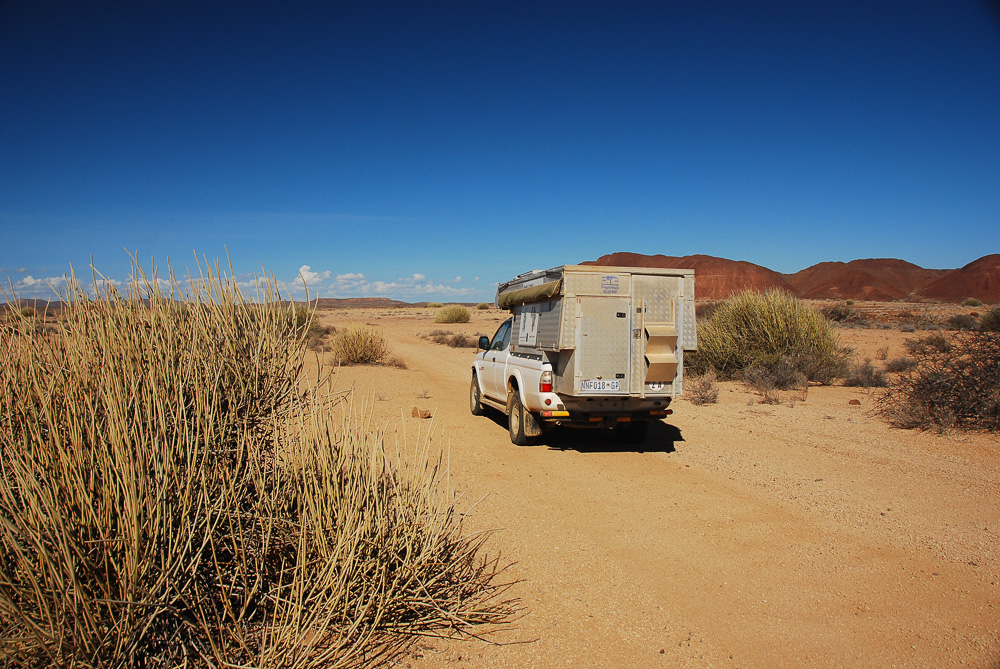
| Damaraland desert: can you spot Stanley? |
We slept soundly in the profound
silence of the desert, and were up just in time for a pretty sunrise over the
mountains inland to our east at 7:00. We
had a quick bite to eat, then went for a morning walk to check out our
surroundings. We headed towards a valley
that cut into the low hills to our north and were rewarded with views of
dramatic rock strata and hardy desert vegetation, along with a new bird
species, the mountain wheatear. We
realized that the gravel plains were solid enough to drive on, and that we
could have driven a lot further off the road and out of possible sight and
parked up for a few days of perfect isolation; we vowed that we would come back
to this area in the future to do just that.
We strolled back towards Stanley, who looked very insignificant in the immensity
of the desert, did some yoga and then rolled off in the direction of Brandberg
West. Our mechanic in Windhoek had
highly recommended a route from Brandberg West to Twyfelfontein, and we were
keen to try it. Our GPS system was less
keen, trying to send us the long way around on main roads, but we didn’t pay it
any attention; we knew where we wanted to go, and no well-meaning machine was
going to stop us!
 |
| Dramatic rock strata near Brandberg West |
In retrospect, the GPS might have
had a point. It was a tough drive ahead
of us, and we didn’t know how tough it was going to be. On the other hand, it was one of the highlights
of Stanley’s Travels in terms of scenery and isolation, so on balance we made
the right decision. Just before
Brandberg West the well-made gravel road reached a T-junction. To the right was the long way around, while
to the left was a distinctly less well-maintained jeep track. We turned left, past an abandoned mine, and
bumped our way slowly to the Rhino Camp, run by the Save The Rhino Trust, on
the bank of the Ugab River. It looked
like a nice place to camp, but I was glad we had been completely on our own the
night before. The caretaker gave us a
photocopy of a hand-drawn sketch map of the route to Twyfelfontein and watched
to make sure we didn’t get stuck in the muddy bed of the river; with all the
recent rains, the Ugab was flowing much further towards the sea than usual, but
with 4WD engaged, it was pretty straightforward.
 |
| The river track from Brandberg West to Twyfelfontein |
That was the last straightforward
driving of the day. For the rest of the
afternoon Terri steered Stanley up river canyons, over steep rises, around
trees, between massive rocks and through a landscape that looked as though it
had hardly been touched by man. We were
now a bit further from the dryness of the coast and there were more substantial
bushes on the landscape, but it was still a dry, unforgiving place. Amazingly this rockscape supports the largest
free-ranging black rhino population left in the world; some 150 individuals
range over a huge area of unfenced land between the coastal desert and the
commercial farms of the central plateau.
Unlike rhinos in many of the national parks around Africa, these black
rhinos are not constantly followed by dedicated anti-poaching units; they are
protected largely by their isolation and by community-based conservation and
tourism outfits like the Save The Rhino Trust.
We began to see the milkbushes on which the rhinos browse, and
occasional droppings, but no rhinos themselves.
The semi-desert supports elephants as well, but they’re even harder to
spot than the rhinos, so although we kept a hopeful eye posted, there were no
charismatic pachyderms to be seen.
 |
| Getting a bit steep in the canyon! |
 |
| Pure freedom |
It took us a long time and some
very concentrated driving by Terri to wrestle ourselves through the canyon that
led us uphill away from the Ugab. No
sooner had we emerged onto flatter ground than we managed to shred a tire on a
razor-sharp rock that was sticking up.
It took over an hour in the heat of day to wrestle our spare tire off
its mounting below the back of the camper and put it on. As we worked, Terri spotted a small
lightning-fast snake zooming around the rocks, looking for something to eat; I
was amazed that it could find enough prey to stay alive. I was also glad that
we had a second spare just in case, as there were plenty of other sharp rocks
around! We continued up a wider valley
and then across rocky highlands into another, much broader valley. We slowly gained altitude until we debouched
out into a beautiful wide-open plain. We
were still 33 km from Twyfelfontein and had only covered 63 km that day, but it
had been very slow, demanding driving and this was a pretty place to make
camp. We drove up onto a rise, turned
Stanley to act as a windbreak again and settled in.
 |
| Passing through the milkbushes, wondering where the rhinos are |
Compared to the previous night’s
campsite, this was a positively lush area.
There were welwitschia plants all over the hillside, along with some
hardy bushes and small trees and lots of dead wood. We gathered together enough for a
decent-sized fire and grilled lamb chops on the coals along with peppers and
onions. It was one of those perfect
evenings that we had come to crave over the course of Stanley’s Travels: a clear star-filled sky, a roaring fire,
delicious food, red wine, lazy conversation and then, after dinner, guitar
music beside the fire in the flickering red glow of the flames. We could have stayed there for days.
Instead, after another night of
sound sleep, nestled under our down sleeping bags against the desert chill, we
got up for the sunrise and then went off for another exploratory morning
hike. This time we headed south, towards
an intriguing canyon that cut into nearby mountains. We walked past endless patches of welwitschia
and down into a broad gorge that must flood occasionally; big trees and dense
bushes flourished in the bottom of the gorge, presumably drawing water from not
too far below the surface. There were rhino
droppings absolutely everywhere, and lots of animal tracks, but again no
rhinos. I think that if we had camped
there a few days, we might have gotten lucky, as the valley was clearly a big
transit route for animals. We were keen to move on, though, so we
made our way back to Stanley to head to Twyfelfontein.
The track did not become
significantly easier that morning, and it continued to demand total
concentration from Terri at the wheel as we navigated steep hills, rock fields
and tricky drop-offs. The hardest
driving was always the steep headlands between valleys. Not far from Twyfelfontein we stopped at a
solar-powered waterhole that was absolutely surrounded by rhino tracks and
droppings. These desert rhinos are
nocturnal, spending the day in the shadow of milkbushes, so we weren’t
surprised not to see them walking around, but it was amazing that they could
hide so successfully during the day in what was a pretty open landscape. Looking at some of the milkbushes, they
seemed crushed on one side, as though a large animal had been sheltering from
the sun by lying on the outlying branches.
It was encouraging to know that, in a world in which rhinos are being
slaughtered at such a high rate, these rhinos were still surviving and thriving
in this empty desolation. On a mountain
top overlooking the waterhole we spotted the remains of what had once been a
tourist lodge; it was hard to imagine that there have ever been enough tourists
in this area to support a lodge.
 |
| Hartmann's mountain zebra |
The last few kilometres out to
the main road at Burnt Mountain were among the toughest so far; it was as
though the track had been left in particularly miserable condition to
discourage the unprepared and unwary from trying to drive on it from
Twyfelfontein. One highlight was
spotting a Hartmann’s mountain zebra, a distinct subspecies with different
stripes, a completely white belly and stripes all the way down his legs to his
hoofs. He wasn’t very close by and
seemed skittish, so we didn’t get great photos, but it was great to tick
another animal off our mammal guide. At
the end of the track, we bypassed Burnt Mountain and the Organ Pipes; Burnt
Mountain we could see from the road (a rather unimpressive black-sided
mountain), and Organ Pipes was a long hike in and we had to pay an entrance
fee. Twyfelfontein lay only 6 km up the
road (we were back on a proper gravel highway) and we were keen to see its San
petroglyphs.
 |
| Twyfelfontein petroglyphs, including Lion Man |
As Namibia’s first UNESCO WorldHeritage site, Twyfelfontein draws in the crowds. There were quite a few cars in the parking
lot, as well as a big tour bus that had just arrived. Terri hustled us along ahead of the bus
tourists (not hard, as they were pretty elderly and moved slowly) and got us
going on our tour. Unlike at many of our
other rock art sites, we had to take along a tour guide, so we didn’t have a
chance to sit and try to sketch what we were seeing. On the other hand, it was remarkably hot at
Twyfelfontein, and it wasn’t the sort of day to sit around in the sun. The site consists of a horseshoe-shaped cliff
with lots of fallen flat chunks of rock at the bottom. On some of these rock chunks San
hunter-gatherers have, over the centuries and millennia, carved petroglyphs
depicting animals and hunters. We had mostly
seen painting sites before, although Phillip’s Cave had been a mix of paintings
and petroglyphs, and it was fascinating to see such a huge collection of carved
hunting scenes. As the biggest
collection of San petroglyphs, Twyfelfontein has attracted lots of scholarly
speculation as to the meaning of the art.
The most famous carving at the site, the Lion Man, is cited as evidence
that the art commemorates the trance state that tribal shamans enter into; the
lion has five toes on each foot (real lions have only four toes, while humans
have five), and its unnaturally long tail ends with a human hand. Other depictions are more natural, and
include just about every animal hunted by the San, as well as seals and
penguins they must have seen during trips to the coast. It was a quick tour, but gave us a good
flavour of the art to be found in this Neolithic Louvre.
 |
| Dassie rat, Twyfelfontein |
After our tour, we sat and
rehydrated (did I mention that it was hot?) and watched a dassie rat scurrying
around under the table; he looked uncommonly like an oversized gerbil. We also topped up our drinking water supply before
driving along the main road towards Palmwag.
We were back in populated country, with Damara villages dotted here and
there across the landscape. Palmwag Lodge is
the entrance point into an enormous private safari concession which extends
over 450,000 hectares, with black rhinos as their star attraction. We spent the evening camped in the rather
pricey main campground (N$ 410, or nearly US$ 30), where we took advantage of
having running water and electricity to have much-needed showers, wash clothes,
bake bread, pre-cook delicious baked beets and Bolognese sauce as well as some
fine chicken curry. That evening as we
prepared for bed, a loud snuffling sound just beyond our campsite had the hair
on the back of my neck standing on end:
it sounded big and near, and I wondered if a hyena was sniffing around
for food scraps. Instead our spotlight
picked out a new animal for us: a
porcupine. He was enormous and comical,
with his quills sticking straight up off his back like a Mohawk, and a
shuffling, hesitant gait to go along with his loud sniffing. Two new animals in one day! We went to bed happy.
 |
| The rugged track through Palmwag Concession |
The next morning I rolled our
flat tire over to the tire repair shop at the lodge. As I had feared, since the rock had punctured
the sidewall, there was no hope of patching it.
Instead we bought a new tire and spent some time reattaching it to the
underside of Stanley. Before driving
off, we walked around the grounds of the Palmwag Lodge, a beautifully
landscaped spot looking out over a dry riverbed that’s apparently a favourite
among desert elephants. We saw lots of
familiar bird species, and then retreated to Stanley for a delicious meal of
roasted beets and potatoes. We then
packed up, bought a permit for camping in the back country of the Palmwag
Concession and drove into the concession for an overnight exploratory drive.
 |
| Perfect campsite in Palmwag Concession |
The landscape was rugged, red and
unrelenting, making for driving that was of a similar difficulty to what Terri had
driven over the two previous days. We
took lots of smaller tracks, looking for game, but we saw little other than one
tiny steenbok and a hardy gemsbok. We
stopped in at Van Zyl’s Gat, a scenic gorge in the dry river valley, and then
continued along to the “campsite” at the confluence of the (dry) Barab and Awab
rivers. It was just a point on the map,
with no facilities, but Stanley had full water tanks, a full larder drawer and
a full refrigerator, so we were completely self-sufficient. It was a very pretty spot to camp, and we
relaxed in the shade of an enormous tree, out of the harsh sun, before Terri
kindled a roaring fire and we cooked up spaghetti Bolognese on our gas
stove. The campfire was perfect, and we
looked forward to exploring the river bed on foot the next morning. I pulled out my faithful Martin Backpacker guitar for some tunes, but discovered that after 16 years of faithful,
intensive service it was failing; the glue that holds it together was dying in
the dry desert air, and the soundboard was cracking; as a result the neck had
twisted and it was no longer possible to tune it in such a way that all chords
sounded good. I improvised by tuning it
to sound OK in E and transposing all the songs into E, but it was clearly
nearing the end of its useful life.
 |
| Desert wood, Palmwag |
There were rhino droppings
everywhere on the ground, so we were hopeful of spotting a black rhino. Just before we went to bed, we couldn’t
resist the urge to experiment by burning some of the rhino poo; after all, in
other treeless areas of the world, like Tibet, dried herbivore dung is burned
as fuel. It burned well, but it
definitely had a fairly rank odour that lingered throughout the night, much to
Terri’s annoyance. We chalked that up as
an experiment that was worth trying once, but only once.
We slept well in the chilly
silence of the desert, disturbed only by the nearby yipping of jackals at 4
am. The following day we woke up to
windless loveliness at our campsite, and went out for a walk along the
riverbed. It was once again a perfect
setting for a walk, utterly isolated from other humans, full of birds and rhino
tracks and poo. Unfortunately the lack
of wind attracted flies, and they latched onto us as the only nearby source of
moisture and food, so we ended up cutting short our walk and retreating to
Stanley. We drove up the Barab River,
through stark, rugged, beautiful landscape.
It was non-trivial driving for Terri, with plenty of technical
challenge, but we were rewarded with a lot more wildlife than we had seen in
the last few days in the arid areas. We
spotted a small herd of kudu making their way across a gravel plain, a large
herd of springbok and several scattered gemsbok. We also spotted a couple of ostriches and two
magnificent giraffe; search as we might, there were no elephants or rhinos to
be seen.
 |
| Desert totem, Palmwag |
The Palmwag Concession is
supposed to be home to the majority of Namibia’s free-ranging rhinos, and they
run an expensive high-end camp, the Desert Rhino Camp, in the southeast section of the concession; they seem to have very good luck in spotting the rhinos, but
we had looked at prices and decided that we weren’t ready to shell out that
kind of money. Another thing that puts
Palmwag on the self-drive 4x4 map is its access, at the northern end, to the
Hoanib River, a well-known dry riverbed that provides a test of 4x4 driving
ability. Since we had unexpectedly just
had a similar experience a few days before, we didn’t feel any need to try
again, especially with rumours of further rain and flooding coming.
By 1:40 we had looped back to the
exit from the concession and regained the main C43 gravel road. Drained by another two days of hard off-road
driving, Terri gladly handed over the wheel to me and let me cover in 90
minutes the same distance we had done in two days. As we drove along the road, the landscape
changed subtly, becoming slightly less arid.
It was still very dry and dusty, but now settlements and villages began
to pop up along the road. Our perfect
desert isolation was over. We were now
leaving behind Damaraland and entering Kaokoland, the home of the Ovahimbapeople, the most colourful of Namibia’s ethnic groups.
Kaokoland: The Himba Heartland
 |
| Desert giraffe, Palmwag |
It was at this point that our
lack of in-depth research cost us. We
drove along the main road towards the turnoff to Sesfontein, and then turned
right, away from Sesfontein, on a direct route towards Opuwa and Epupa
Falls. As it turned out, this route lies
too far from the coast to be through uninhabited arid land suitable for wild
camping. Looking it up afterwards, we
would have had a better chance of finding wild places to camp had we turned
left, driven past Sesfontein and towards Purros, much closer to the coast. On our chosen route, there were villages
every few kilometres and herders driving cattle and goats everywhere inbetween. We were crossing the Joubertsberge, a highland
area, and it was difficult even to see where it would be possible to drive off
the road in most places. Keeping our
eyes peeled unsuccessfully for wild camping spots, we ended up driving all the
way to Opuwa, where we arrived in the late afternoon. After days of passing through bush and tiny
settlements, Opuwa was a shock, a big town, regional capital and service centre
to the surrounding Kunene region. We
were filling Stanley’s tanks with diesel when I suddenly wondered why we were
tilting to one side. I walked around
behind Stanley and found one of our back tires almost flat. I asked to use the gas station’s air
compressor, only to find that it was out of order. I pulled out our small compressor and
refilled the tire, but the sound of air rushing out convinced me that we
weren’t going to get far on this tire. Luckily there was a tiny tire repair
joint across the road, and after some hard bargaining we got the gash
repaired. We both wondered, only half
jokingly, whether the tire repair people spread tacks across the road just
outside town; our flat tire had clearly happened not very long ago, and the
repair shop was doing a very brisk business.
We had given up on wild camping
for that evening, and sunset was drawing near, but Opuwa didn’t appeal to
either of us as a place to spend the night.
We drove off towards Epupa Falls, looking for wild camping possibilities
(it was too densely settled) and following a GPS suggestion that there was a
community campsite ahead. We found it
(despite a distinct lack of signs) at the Ovahimba Living Museum, about 45 km from Opuwa. It was after sunset and the
campsite was devoid of other customers, but it turned out to be an inspired
serendipitous choice. The young Ovahimba
man who ran the place, John, was engaging and funny and full of
information. We fired up a campfire to
sit around after dinner and were just settling in for a good chinwag when the
skies opened up and sent Terri and I scuttling back to Stanley and our bed.
 |
| Owl droppings, full of tiny bones and claws |
The next morning (Monday,
February 27th) we woke up to a beautiful setting, with dense bush
spilling down the slopes of a large hill and a big cave right behind us. I woke up early to the sound of birds, but
despite some assiduous searching, I found it hard to spot anything. Eventually, though, I was rewarded with my
first spotting of a Damara hornbill high in the trees. We walked up to the cave with John in search
of San paintings. There are a few, but
they’re chipped, faded and blackened by smoke.
On the positive side, though, the setting and the view from the cave are
magnificent, and the cave is also home to a resident owl and several bats. We didn’t spot the owl itself, but we found
its droppings, full of tiny bones and claws from the small nocturnal animals it
hunts. We returned to Stanley for
breakfast and to pack up, then went across to the Living Museum itself, another
project started by the entrepreneurial John.
 |
| Himba baby |
We found a small village of wood
and adobe huts, lived in by maybe 10 families.
John was quite proud of the fact that the people in this village wear
traditional clothing uncorrupted by cheap Chinese textiles. We paid a fairly reasonable admission price
(N$ 250, if I remember correctly) which paid for a song-and-dance show. I am often not a big fan of this sort of cultural
tourism, as it often seems staged and artificial, but this was different. There were five Ovahimba women, magnificent
with their ochre-and-mud plaited hairdos, their bare breasts and their babies
on their backs, and four Ovahimba men, athletic and tough. They stood in a semi-circle, slightly
self-conscious as they sang and clapped, and after a while one or two of them
would detach from the group to dance.
Terri and I both got invited up to dance, and it really was a lot of
fun. After a while, as the dancing died
away, we walked around the village, chatting (through John) with the women. It was neatly kept, and as John pointed out,
there was no plastic rubbish littering the ground as is so often the case in
Africa.
The project seems to provide an
economic basis for these villagers to continue living their traditional
lifestyles with their goats and cattle and maize crops while generating enough
cash income to function in the modern economy.
We were impressed by the pottery that the village produced, and the
potter, the oldest female dancer, posed proudly with her creations. On a sadder note her son sat beside the
village in a wheelchair selling souvenirs and handicrafts; he had been injured
in a car crash months earlier and was finding it difficult to get any medical
care, even in the town of Opuwa. His
condition was apparently improving, but only very slowly, and he clearly would
have benefited from proper physiotherapy.
Seeing cases like this makes you realize that access to medical care,
like access to decent education, is one of the key drivers in the great wave of
urbanization taking place all over the world.
 |
| John and the man he's trying to help |
 |
| Dancing at the Ovahimba Living Museum |
We drove away from the Ovahimba
Living Museum pleased with our luck in having stopped there. There were no other commercial campgrounds to
be seen along the road, and very few wild camping chances as the countryside
continued to be fairly populated. We
drove 145 km north along a decent dirt road, gradually descending from the
plateau towards the Kunene River which forms the northern border of Namibia
with Angola. It was dry, dusty country,
but the dryness and dustiness was increased by the obvious overgrazing by
goats. We found ourselves longing for
the unpopulated wilderness of a few days previously. By 2:00 we had arrived in Epupa village. After looking through all 3 of the main
possibilities, we settled on Epupa Camping; since we were planning to spend a
couple of nights, we wanted a good location, and Epupa Camping, despite the
above-average cost of N$320, offered the most isolation and the best
views. We chatted with our neighbours,
went for a run (Terri was finally able to run on her injured leg for the first
time in 5 months) and had one of our best-ever sunsets. However as we polished off the end of our
spaghetti Bolognese it began to rain and we took shelter under our awning, glad
that we had upgraded from our previous toy awning.
 |
| Epupa sunset |
 |
| Epupa Falls: the main cataract |
Tuesday was the last day of
February and it was a delightful day of no driving. We lazed over breakfast, then walked along
the Kunene River downstream to the falls themselves. Namibia is a country almost without rivers;
other than the Caprivi Strip, its two permanently-flowing rivers are theKunene, forming the northern border with Angola, and the Orange River, forming
the southern border with South Africa.
After weeks of driving around the country without seeing flowing surface
water, it was a bit overwhelming to see the volume of flow surging over the
falls and plunging down into a narrow cleft in the rock. The Kunene is fed by rainfall in the highlands
of Angola, and looks strangely out of place flowing through the dry semi-desert
of northwestern Namibia. We picked our
way downstream, getting different views of the falls; like Iguazu Falls in
South America, it’s composed of perhaps a hundred separate waterfalls spaced
out over a length of a kilometre and a half, and it looked very different from
every spot we stopped for photos. We had
a good hike and spotted lots of birds.
As an oasis of moisture in a very dry part of the country, the Kunene
River attracts a lot of birds not seen in the rest of Namibia, and lots of the
tourists at Epupa Falls were keen birders.
I found it equally alluring to gaze across the river at forbidden Angola
and wonder what it would be like to explore.
We had found a year before that as non-residents in South Africa, the
Angolans wouldn’t give us a visa in Cape Town; if we ever do want to drive
Stanley north into Angola, we’ll have to get visas ahead of time in Canada and
New Zealand (or the Netherlands and Switzerland?). We walked back to our campsite, lunched and
then spent the afternoon running, reading and sorting photos. As we went to bed after eating the last of
our curry (that one night at Palmwag Lodge campsite had produced a lot of food
for the following days), it began to spit rain again.
 |
| An overview of Epupa Falls |
Wednesday, March 1st
we woke up to grey skies, and after a quick breakfast of muesli, it began to
rain a little more seriously as we packed up.
We were driving upstream along the Kunene on what had once been a
hair-raising 4WD track; it had very recently been improved into a proper gravel
road, and what had once taken 2 days was over in two and a half hours, as we
rolled into the small town of Swartbooisdrift after 80 fairly uneventful
kilometres. The new road was in great
shape and led through pretty country right beside the river, dotted with tiny
Ovahimba villages. It was just as well
that the road was good, as it started to rain harder. We congratulated ourselves on having survived
the worst stretch of road and continued driving along the river towards Ruacana
Falls.
 |
| Epupa Falls |
The self-congratulation was
rather premature, as it became immediately clear that the work crews had not
yet gotten to this part of the road.
There was no gravel base and no drainage, and with the heavy rain the
clay surface of the road was as slippery as a skating rink. It was only 35 km to the end of the track and
the beginning of asphalt at Ruacana and it took over 3 hours of white-knuckle
4WD work by Terri. We spun sideways half
a dozen times, and once or twice began to slide sideways on the slight camber
of the track straight towards a drop into the river. The absolute worst, though, was near the end
when we had to drive down a steep hill on slippery clay; we were in low-range
4WD and still nearly ended up facing backwards in the ditch. It was an impressive tribute to Terri’s
driving skills that we arrived in one piece at Ruacana Falls. We had planned to camp there, but it was
still bucketing down rain and we decided to use up the poor weather in
travelling, rather than camping in a downpour.
Ruacana Falls had apparently once rivalled Epupa for its awe-inspiring
beauty, but a huge hydroelectric dam now diverts most of the flow through
turbines.
Along the Caprivi Strip
 |
| Himba women with spectacular hairstyles |
At the town of Ruacana the road
finally pulled away from the Kunene River and entered into the flat, rather
dull agricultural heartland of Namibia.
Namibia is divided in two by an agricultural fence, the Red Line; to the
south of this line there are big commercial farms, and to the north lie communal
lands. Since the commercial farmers are
mostly white and the communal farmers are almost entirely black, that Red Line
is sort of the boundary between the white and black areas of the country,
although there’s no formal apartheid-style separation of the races like
that. The area through which we were
passing, the home territory of the Owambo people, is not inherently
interesting, so we wanted to zip through at speed on the way to the Caprivi
Strip. However, the upshot of being
north of the Red Line (we had passed through it just outside Palmwag) was that
there are very few fences around farms, leaving cows and goats to roam freely
across the road. Between the cows and
the continuing rain, we made slower progress than you might expect. We ended up camped in the junction town of
Ondangwa in a “rest camp” that was really a big muddy parking lot around a loud
restaurant. There had been so much rain
there that day that Stanley sank right into the ground and we needed to engage
4WD low range to get him out again. We
were tired and settled for a pizza at the restaurant before collapsing into
bed, where we tried to sleep through the racket being made by our drunk
neighbours.
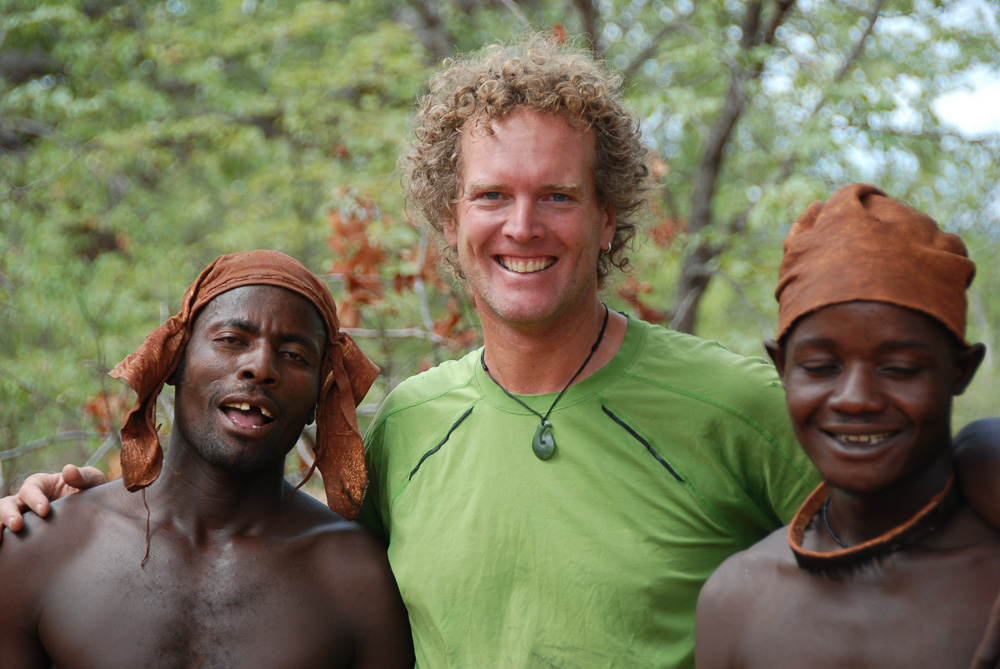 |
| Me with two of the Himba dancers |
The next day was not one of the
finest days of our trip. We were on our
way towards Livingstone, Zambia, for the last time on this trip to do some work
at Terri’s school there, the Olive Tree Learning Centre. It was a long, long drive, so we made decent
kilometres that day along a monotonous road full of straying livestock and not
much else. It had been raining heavily
over the previous few days and the ground beside the road was saturated and
full of puddles. (Two weeks later this
area would completely flood as a pulse of water draining from the Angolan
highlands arrived downstream and overflowed the banks of the dry river
channels. The El Nino drought is most
certainly over in most of southern Africa.)
Partway along the road we noticed that our indicator lights were
behaving strangely, sometimes not going on, sometimes going on but not flashing. We decided that this was the sort of thing
that traffic cops would fine us for, so we thought it would be a good idea to
go to an auto electrician to get it sorted out.
The sizeable town of Rundu seemed like a good spot to do this; looking
for campgrounds on our GPS and our Kavango tourist map, we found a few
likely-looking camps just west of Rundu and set course for them.
The Kavango River, better knowndownstream in Botswana as the Okavango River (as in the Okavango Delta) joined
us from Angola not too far west of Rundu, and since it is a legendary fishing
and birdwatching river, its banks are dotted with campgrounds. The first one we tried, about 50 km outside
Rundu, was impassable thanks to flooding; we tried to drive in, but the water
and mud just kept getting deeper and deeper, while a sign recommended driving
along a nearby road and then taking a boat.
We gave up and decided to stay right in Rundu town, which turned out to
be a very expensive mistake. The first
campground we looked at in Rundu was rejected because it looked run-down and a
bit too much like the municipal campground in Upington where our chairs and
table got stolen. Instead we opted for
the Sarusungu River Lodge on the outskirts of town, right on the banks of the
Kavango River looking out towards Angola.
We found a pretty site on the lawn and set up camp. There were plenty of birds to look at, and
the rain that hit just as we arrived had stopped in time for a nice campfire
and braai. We sat outside eating,
drinking wine and enjoying the atmosphere.
 |
| A proud potter and one of her pots |
As we were going to bed, we
couldn’t find Terri’s binoculars, which I had put inside the cab of the truck
just before dinner. We didn’t think too
much about this, but the next morning, as we were cooking up a feast of bacon
and eggs, I had another look and realized that not only were her binoculars not
in the cab of the truck, neither were my binoculars nor my camera bag. With a horrifying sinking feeling, we
realized that while we were eating the previous night, someone had sneaked up
behind the truck, opened the driver’s side door and grabbed what he could from
the interior. My camera equipment, which
had served me so well for a decade of travel, was gone.
The rest of the morning was a
complete write-off. We told the hotel manager,
who (only now!) told us that there was no night security guard, an absolute
necessity at any well-run campsite. He
called the police and after a long wait some detectives came out to
investigate. They struck me as pretty
competent, so I had some faint hope that they might eventually recover the
stolen gear, but our experience at the police station in town, where we had to
go to open the case officially, put an end to this fond hope. We stood in line (if a milling scrum can be
considered a line) while the desk officers kept their heads down and studiously
ignored everyone. After an hour and a
half, we only got served because one of the detectives wandered by and we
collared him and enlisted his help. A
very bored female officer filled out the form and gave us a case number and we
were finally free to go.
The great irony is that the only
reason we wanted to stop near Rundu was to get the indicator lights seen to,
and as we left town, the only auto electrician we could find online was nowhere
to be found in the physical world of Rundu.
We drove off, materially poorer and with malfunctioning indicator
lights, not in the best of moods. We
looked in at River Dance Lodge as we continued east along the Kovango: it was a soggy 4WD slog to get there from the
highway, and while it was pretty, it was pricey (N$600 a night for the two of
us, or nearly US$ 45, just to camp) so we turned it down and continued along
the road towards the junction town of Divundu.
We picked another camp along the river, Ngepi Camp, from our guidebook,
plugged it into the GPS and drove along as the afternoon turned to evening,
looking for it. It was about 10 km down
the road towards the Botswana Border and 4 km along an exceedingly muddy track
decorated with very amusing road signs.
We pulled into camp in complete darkness and had dinner at the
restaurant before setting up camp and retiring to bed.
 |
| Amazing hairdo! |
We discovered in the morning that
we had chosen well. Ngepi is an oasis ofbeauty along the river, well run and cleverly designed, with lots of quirky,
amusing names and structures. The
toilets and bathrooms each have great views, usually over the river, and each
campsite is nestled beside the river, sheltered from its neighbours by generous
stands of trees. The place is a
birdwatcher’s dream, with different sets of species in and around the river, in
the dense riverine thickets and in the grasslands further inland. The camp sprawls a long way along the river,
but never feels overcrowded, even when a big overland truck pulls in (they have
their own separate part of the complex).
There are fairly luxurious riverside cottages and “tree houses” for
those who aren’t camping, and 22 campsites for the likes of us. It was a beautiful place to unwind and to try
to forget the theft. We had a long,
leisurely breakfast of pancakes and bacon, went for a few exploratory walks,
ran, did some yoga beside the river and then sheltered from another torrential
downpour in the later afternoon. We had
some penne with a salmon and cream sauce (we were trying to eat our way through
our dry food and tinned supplies) and then sat around a fire once the rain had
abated, sipping fine pinotage wine and enjoying the sounds of the night,
including the nearby splashing and grunting of hippos and the sound of elephants
across the Kavango River in the national park.
It was such a lovely place that
we resolved to return to stay there in a few days as our farewell to Namibia. We were down to very few days left on the
continent; it was now the evening of March 4th, and we were flying
out of Windhoek on the morning of March 16th. After a year of travel, being down to 12 days
on the clock was a bit sad, and we wanted to make sure that we made them all
count.
A Zambian Sidetrip
On Sunday, March 5th
we had a long day of driving to get to Livingstone, Zambia. We drove to the eastern end of the Caprivi
Strip, then southeast into Botswana at Ngoma Bridge. We cut across Chobe National Park on the
transit road (on which you don’t have to pay park fees); we spotted a few
baboons and impala, and a magnificent male sable antelope. From Kasane, at the eastern end of the park,
we continued to the ferry at Kazungula, where we crossed into the unpleasant
chaos of a Zambian border crossing; after the orderly, organized border
crossings in South Africa, Namibia and Botswana, it was a rude return to
reality. We fought our way through the
chaos, paid our extortionate visa and car import fees (they added up to over
US$ 150 between the two of us) and drove the final 60 km into Livingstone. We headed directly to the calm of Olga’s Italian Corner for a celebratory meal, then set up camp at JollyboysCampsite, where we had spent two weeks back in August.
 |
| Himba singing |
The two full days we spent in
Livingstone were, in fact, full, packed with errands and jobs to do. Terri wanted to make sure that Olive Tree
Learning Centre (OTLC), the community pre-school and primary school that she
has supported and worked with and fundraised for over the past decade, was on
firm financial footing. In 2016 the
last-ever group of students from Kumon Leysin Academy in Switzerland (KLAS),
Terri’s school, had come for 10 unforgettable days, having raised a bumper crop
of donations. Much of that was spent on
building a new school building that allows OTLC to go up to grade 3 this year
and grade 4 next year, as well as providing space for a library, computer
classroom and space for income-generating activities. Terri spent a lot of time getting the banking
and bureaucratic details of running the school sorted out, and we got to see
the new building in full use. Terri even
bought a sit-down toilet for the school latrine for the teachers and any future
volunteers to use. I was amazed at the
atmosphere of calm, studious activity that we saw at the school; the various
teachers have grown and matured into their roles and now lead their classes
with great confidence. I always feel
proud of Terri’s accomplishments when I see OTLC, and never more so than on
this visit. I hope that OTLC continues
to grow and thrive while giving hundreds of young Zambians a chance to get a
solid educational grounding for their futures.
At the end of the second day, we
went out for one last sunset at the Royal Livingstone Hotel, where our trip
began almost exactly one year earlier.
As usual there was a dramatic sunset over the Zambezi River that lit up
the plumes of water vapour rising from Victoria Falls. There was a sense of closure, of completing a
year-long circle, as we sat there basking in the last embers of the
gloaming. From now on, everything would
be backtracking back to Windhoek.
Wednesday, March 8th
found us retracing the day-long trek back across Botswana to the Caprivi
Strip. Once again the Zambian side of
Kazungula was a disgraceful mayhem, with a mafia of touts and would-be
car-watchers, liars and scam artists besieging the border crossers. It felt good to roll off onto the other side
into the calm of Botswana. We had a
series of slight delays that all added up to us rolling back into Ngepi Camp
well after dark, where we took the most distant and isolated of the campsites,
number 22, which we had scouted out during our previous visit.
The Final Days: A Charmed Existence
We spent four delightful nights
and three indolent days in Ngepi, watching the river flow by, sheltering from the
persistent rain (it finally let up the day before we left), trying to fish (I
managed to lose all my remaining hooks and sinkers, along with a rather nice
lure borrowed from the camp office, on snags.
No fish were harmed in my attempts to fish.) Terri and I, acutely aware of how little time
we had left, savoured every evening with its campfire, braai, wine, stars and
sounds of hippos. It seemed as though
this past year had been leading up to this, camping in an area of great natural
beauty, watching birds, cooking, eating well, going for runs in the bush,
talking with interesting fellow travellers (a couple from Martha’s Vineyard
were particularly interesting; he is a scuba instructor who has worked all over
the world, further firing my desire to do the same over the next few years;
they are travelling with a drone, and had some great footage of hippos taken
over the river), and generally relaxing and drinking in how fortunate we have
been to do such a wonderful, life-altering trip.
 |
| Stanley at our first desert campsite in Damaraland |
Despite our complete lack of
binoculars and camera, we still managed to tick off a few new bird species: the chirping cisticola, the grey-backed camaroptera, the yellow-bellied greenbul and the African barred owlet. I was particularly proud of our spotting of the
owlet, as we heard it calling in the night while we were sitting by the campfire. We recognized it as an unfamiliar call, and
thought it sounded owl-like, so we sneaked up on the source of the sound
quietly until we could see it silhouetted against the moonlight, then turned on
our spotlight and saw it very clearly for five seconds before it flew off in
annoyance. The majority of the South
African and Namibian tourists at Ngepi were there either for the birding (there
were some very serious twitchers around) or the fishing, so we felt we were
making the most of the opportunities for both.
Our last night at Ngepi, Saturday
March 11th, was almost elegiac, as we had so few nights left inside
Stanley. We had had our first rainless
day in a long time, and I braaied some luscious lamb chops over the embers of
our wood fire before we stoked it up again into a roaring inferno. That was the night that we tracked down our
owlet, and we basked in the glow of our achievement as we sipped our crisply
chilled Sauvignon Blanc and followed it up with the last of our Bowmore Black Rock single malt, which we had been carrying around for a couple of
months. The moon was almost full and lit
up the ripples on the fast-flowing Kavango, and we heard the hippos splashing
disconcertingly nearby. It could not
have been a more fitting ending to the outward leg of Stanley’s Travels.
We still had a long drive back to
Windhoek, and we did it in one long day (515 km) to near Grootfontein, and two
shorter days (343 km and 260 km) to Otjira Lodge and Trans-Kalahari Lodge. Leaving Ngepi, we were awoken in the pre-dawn
by hippos who had been out grazing and who were snorting directly beside
Stanley; we were glad to be sleeping well above ground level! Then as we made breakfast we could hear a distinctive
animal sound from across the river, like a handsaw cutting through a log; the
owner of Ngepi was passing by from his house (just beside campsite 22) and told
us that it was a leopard. We had a
prolonged look across the river, but although the sound continued and moved
upstream, we never spotted the leopard.
We drove to Rundu and stopped in briefly at the useless police station,
where we got no help at all on the case of the stolen camera, then angled south
towards Grootfontein. We passed through the
Red Line at a veterinary checkpoint (as usual, no meat and fresh animal
products are to be taken from the communal farming area to the north into the
foot-and-mouth-free zone of commercial farms to the south of the fence) and
suddenly the landscape was transformed.
Gone were the sprawling villages and livestock standing in the middle of
the road; in their place were huge, almost empty tracts of commercial
farmland. Just before Grootfontein we
turned off towards Bush Baby Lodge (not to be confused with the lovely spot we
camped near Hluhluwe National Park over New Year’s Eve) and camped in a sadly
neglected campground there. It was a
lovely setting, and we had the obligatory campfire and braai, grilling up a
boerewors, the delicious farmer’s sausages to which we had become addicted over
the past couple of months. It was the
last full moon of the trip and it peeked out briefly between clouds before we
retired to bed.
Monday, March 13th we
continued south to Otjiwarongo, where we did our last grocery shopping of the
trip, then visited the amazing AfriCat foundation south of town. A jovial ex-teacher named Johan, whom we had
last seen as the temporary manager of Trans-Kalahari Inn a month ago in
Windhoek, had just started working as the educational outreach officer at
AfriCat and Terri was curious to see the operation and to investigate the
possibility of having a group of overseas students come and do a few days at
the educational camp. AfriCat is doing
for leopards and cheetahs what Moholoholo is doing in South Africa for all
sorts of wildlife: providing a place to
rehabilitate big cats who are involved in conflict with local farmers and villagers. It was a beautiful place, and we are both
keen to go back sometime leading a school group, as it would be an
unforgettable experience of a lifetime for high school students. Bidding a fond farewell to Johan, we drove
back towards Otjiwa Lodge, a place we had stayed at a month previously on our wayback from Etosha. We camped again in
campsite 10, the furthest removed from the lodge and from other campers, and
had our last night in Stanley. Luckily
the weather was perfect, the campfire blazed merrily and we had a claret sunset
that took our breath away, even after the hundreds of great sunsets we had seen
over the previous twelve months. The just-past-full
moon rose in the east an hour later in a blaze of orange glory just as we were
tucking into some sosaties (skewers of meat, vegetables and other goodies) and the
best baked sweet potato either of us had ever tasted. We lingered beside the fire as I played tunes
on the hopelessly out-of-tune cracked ruin of my Martin guitar, reluctant to
say goodbye to an outdoors lifestyle that we had been perfecting right up until
the end. Finally, though, we crawled up
into bed to sleep on our ridiculously thick and comfortable mattress, lulled to
sleep by the now-familiar sounds of the African night.
And then, suddenly, shockingly,
it was over. We drove into Windhoek the
next morning and stopped to spend N$ 150 (US$ 11) to get Stanley thoroughly
washed and cleaned, inside and out. We
made it to Trans-Kalahari Inn in the early afternoon, just ahead of a
tremendous rainstorm, and had a long afternoon siesta, suddenly tired now that
all the travelling was over. Terri
cooked up the last fabulous lamb stew of the trip and we struggled with poor
quality internet, trying to arrange our post-Stanley travels and lives.
Wednesday, March 15th
found us busy all day, cleaning, packing and putting Stanley away. We pulled out almost everything from inside,
cleaned what we could with a shop vac and lots of soap and water and elbow grease,
then packed away everything that we weren’t taking with us. It was a lot of work, but worth it. By the end of the day (which was mercifully
sunny and dry) Stanley was spic and span and ready for a year (or two) in storage. We had decided in the end to store him at
Trans-Kalahari, since Ondekaremba seemed to have security issues; after the
debacle in Rundu, security was paramount in our minds. There are a lot of vehicles stored at
Trans-Kalahari, many of them Dutch and German and Swiss; their owners have
mostly shipped them down to Walvis Bay and fly down once or twice a year to do
a month’s travelling.
We paid our fees
(at N$ 6000, or US$ 450 for a year, it’s a relative bargain) and on the morning
of Thursday, March 16th we drove Stanley into one of the huge
hangars on the property, handed over the keys and caught a lift to the nearby
airport. A blur of flights
(Windhoek-Johannesburg-Dubai, where Terri and I parted ways after 19 months of
being almost inseparable, then Dubai-Auckland for her and Dubai-Toronto-Thunder
Bay). Eight and a half months of
overland travel around southern Africa, some 35, 178 kilometres, were at an
end, but already we were thinking about where we want to go the next time we
fly to Windhoek to start Stanley’s Travels 2.0. (Spoiler alert: Damaraland and the Kaokoveld figure prominently in these plans!)
It's only been 4 weeks since we left Namibia, and already it seems a lifetime and half a world away. It's astonishing how quickly we adjust to another mode of existence! Stay tuned for a few more blog posts and an updated Google Map over the next few weeks as I try to tease out the absolute best places and experiences from what has been an amazing trip in every respect.
